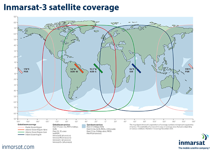
Inmarsat presently operates 10 satellites in geosynchonous orbit, which means their position appears to be fixed when viewed from the Earth.
The satellites are positioned to transmit radio beams in two global configurations, four covering the oceans and three the major landmasses. Their combined footprints provide seamless worldwide communications coverage, except in the extreme Polar Regions.
Beams cover oceans and major landmasses
As Inmarsat was founded as a maritime communications operator, our first wholly-owned constellations – the Inmarsat-2 and Inmarsat-3 series – are located above the world’s sea-lanes to form four ocean regions:
- Atlantic Ocean Region West (AOR-W), at 54 degrees West
- Atlantic Ocean Region East (AOR-E), at 15.5 degrees West
- Indian Ocean Region (IOR), at 64 degrees East
- Pacific Ocean Region (POR), at 178 degrees East.

Following the full deployment of the Inmarsat-4 (I-4) satellite constellation in 2009, a further three satellite regions were created over the Earth’s major landmasses. They are:
- I-4 Americas, at 98 degrees West
- I-4 EMEA (Europe, Middle East and Africa), at 25 degrees East
- I-4 Asia-Pacific, at 143.5 degrees East.
From November 2013, I-4 EMEA is covered by Alphasat (I-4A F4) with a new footprint, as illustrated in the map below.
